
01 / PROPERTY
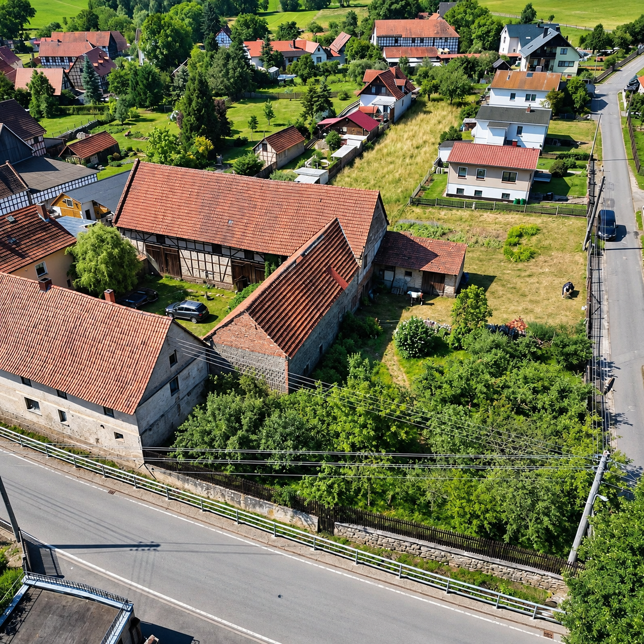
Aerial property imagery
Show buyers the space, views and setting that make your property worth a closer look.
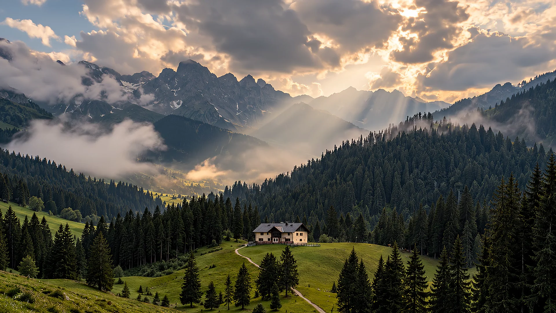
Drone photography, inspections and surveys · Slovenia
Aerial photos for a property listing, a roof inspection before renovation or measurements for construction work. We prepare the images and data for the job you have in mind.
Izberite storitev
Choose the area that interests you.
Open the details to see its uses and what you receive.
Show buyers the space, views and setting that make your property worth a closer look.
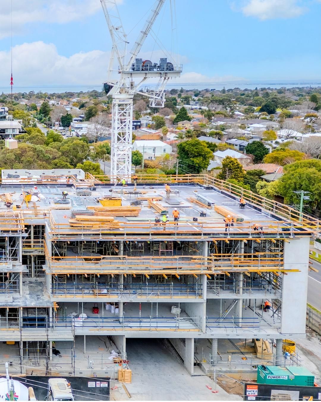
Keep track of site progress and focus maintenance on the areas that need attention.
Spot signs of heat loss and overheating to guide a closer inspection.
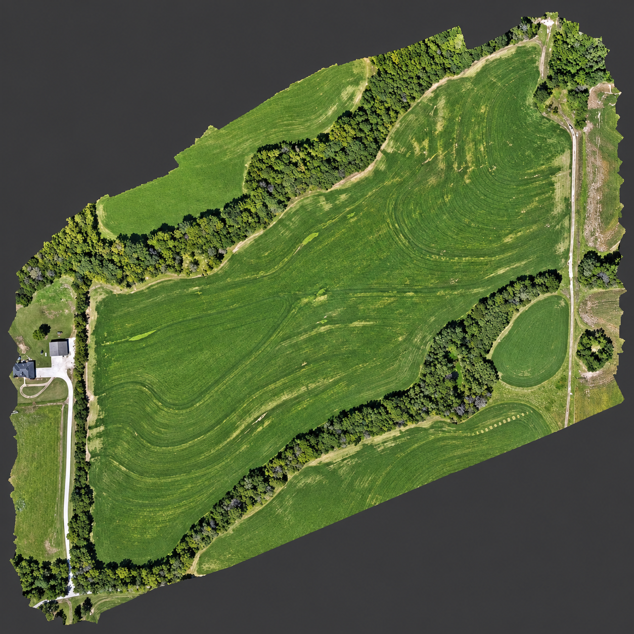
Plan work using measured areas, material volumes and a map of crop conditions.
We choose the angles and flight height around what you want to highlight: the size of the plot, the house's setting or the view. Use the images in a listing, on your website or to introduce a holiday rental.
Repeat visits create a record of the work, while close-up views document the condition of structures. Share the evidence with contractors, investors or the specialists planning maintenance.
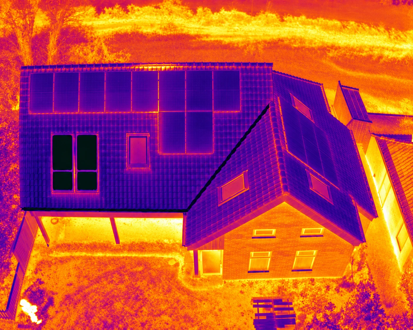
We compare thermal and ordinary images and mark temperature anomalies. This locates areas for further diagnostics; a specialist assessment is needed to establish the cause.
Normal camera / thermal camera
Discuss this serviceWe combine aerial images into an orthomosaic map or a surface model. From this base, we measure selected areas, compare survey dates or map differences in vegetation.
How we work together
You don't need to know the equipment or capture methods. We recommend them around your goal.
Share the location, approximate scope and preferred timing. Tell us how you plan to use the result.
Receive the proposed scope, price and timeframe. We coordinate the capture with site access and suitable weather.
We deliver organised files and explain the measurements and observations, ready to share with your contractor, client or buyers.
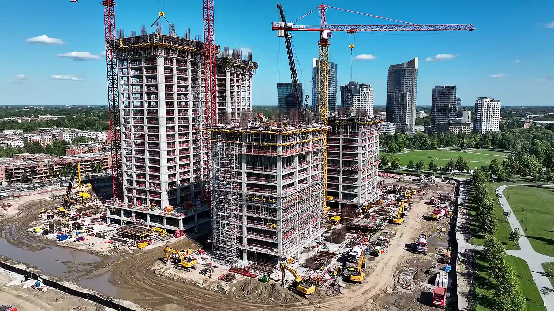
Successive visits preserve the intermediate stages that the finished building hides. The archive documents how the work unfolded and supports project reporting.
Your next step
Enter the location and briefly describe the task. We will respond with a recommended service, scope of work and price.
FOR YOUR HOME AND LAND
Before a renovation, a landscaping project or a sale, get a practical reference you can share with your contractor or buyer.
Explore the services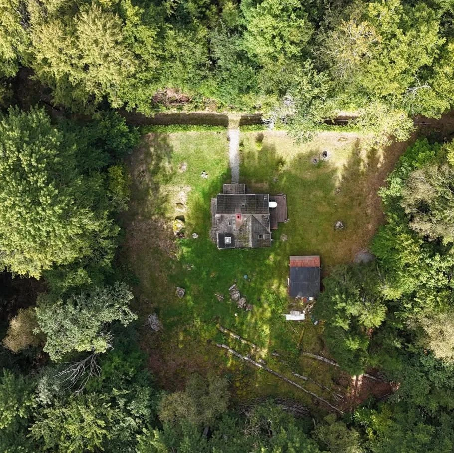
Planning a build or renovation? Record the routes of pipes and cables while they are still visible, and make future digging, drilling or repairs easier.
We capture the property before work begins, then record exposed pipes and cables during construction, before the trenches are filled. This preserves a clear record of electricity, water and drainage routes in relation to the house and its surroundings.
We photograph pipes and cables during installation, before plaster, wall finishes or floors cover them. Once the work is complete, we photograph the rooms again to relate the installation images to the finished space and make their positions easier to identify.
We can also add an indicative view of property boundaries using cadastral data or your documentation.
Existing concealed pipes and cables are marked from your plans or information; imagery does not detect them through walls or soil. The boundary overlay does not replace a cadastral boundary survey. Verify utility positions on site before carrying out work.
We combine several photographs into one continuous top-down view. Mark your proposed changes on it and use it to agree the layout with your contractor.
Distance and area measurements can be added by agreement.
Rotate the model to explore views a flat photograph cannot show. See the slopes, the position of buildings and how they sit within the surrounding land.
A digital model with simple viewing instructions.
A view, a generous garden or a quiet setting can be the reason someone books a viewing. Selected aerial angles highlight your property's strengths and complement the interior photographs.
Edited photographs, ready for your property advert.
Before upgrading insulation or arranging a service visit, find the areas worth investigating more closely.
We look for temperature anomalies on walls, roofs and around windows. These can indicate weak insulation or thermal bridges — places where heat passes more readily through the structure.
We compare panel temperatures and mark anomalies. The images help you show your installer which modules warrant attention.
The images include marked locations and a plain-language explanation of our observations.
Planning a build, renovation or property sale?
Send an enquiry ↗CONSTRUCTION · INFRASTRUCTURE · ENERGY
Investors, site managers and maintenance teams need different information. We tailor the capture to the documentation you need for coordination, condition checks or material records.
Explore the services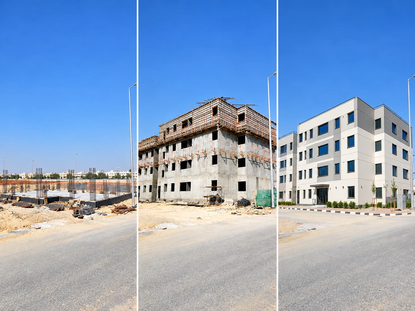
We schedule visits throughout the build, including multiple intermediate stages. Images of the same areas from matching angles make progress comparable and preserve details that later work will cover.
Where needed, georeferenced orthomosaics and 3D models add a spatial basis for comparison.
The documentation is organised by date and prepared for reporting to the investor.
Local hot spots can indicate problems in photovoltaic (PV) modules. Thermography locates these anomalies for further electrical diagnostics.
Capture takes place under suitable irradiance and operating conditions. Thermal and ordinary images document the location of each anomaly.
We capture close-up views of insulators, crossarms and joints, marking visible damage or corrosion. This helps identify which elements need further assessment by a specialist team.
Annotated photographs link each observation to the inspected element's location.
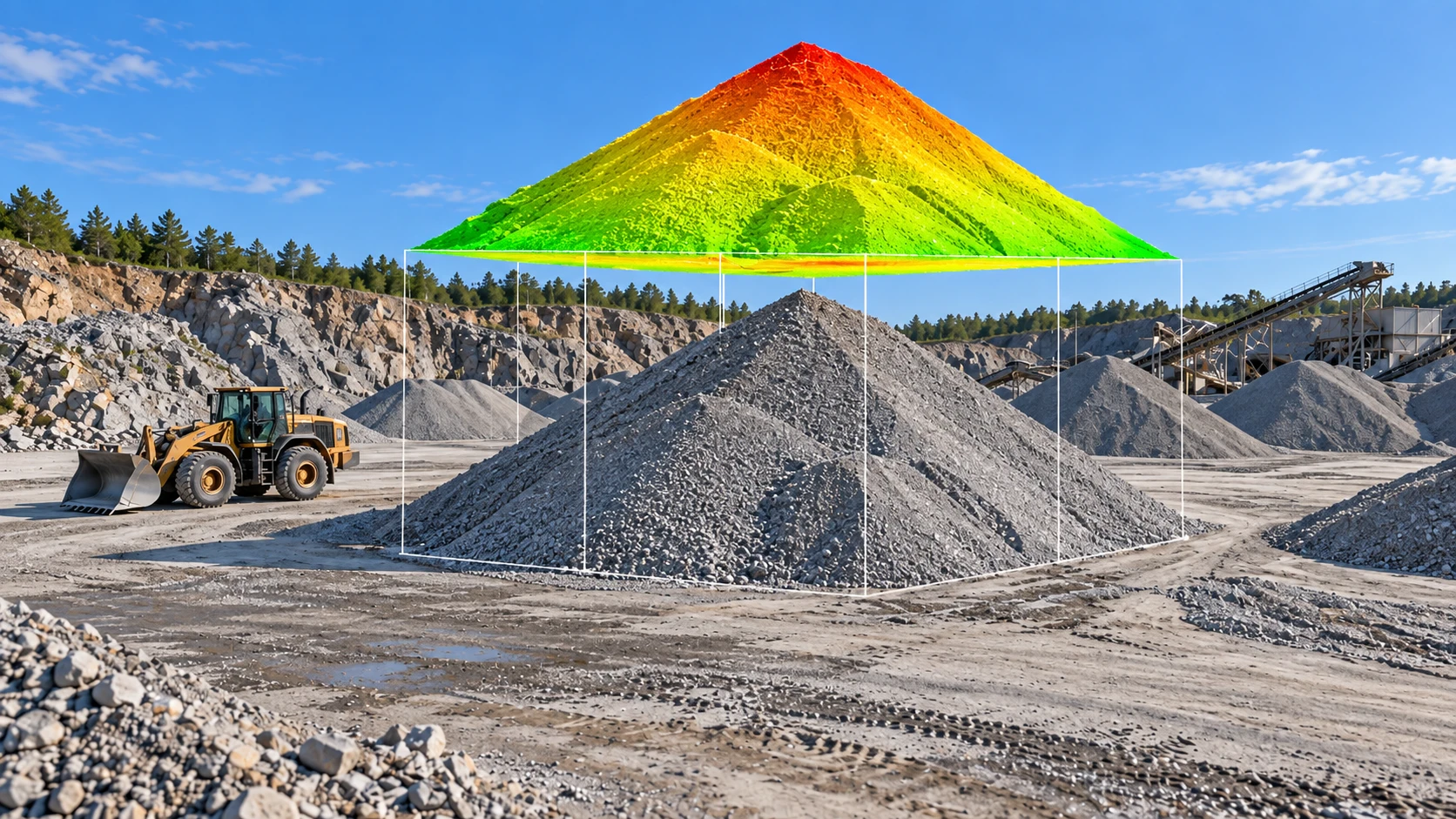
How much material has left the site, and how much remains in the stockpile? Photogrammetric models provide volumes; repeat surveys support cut-and-fill balances and show where quantities have changed.
Volume tables in m³ are accompanied by marked measurement areas and a comparison between survey dates.
We agree the reference surface, control points and required accuracy before capture.
Let’s include aerial capture in your next project.
Send an enquiry ↗FIELDS · MEADOWS · ORCHARDS
A large field is hard to assess from its edge. An aerial view helps you choose where to inspect and plan work around the actual condition of the crop.
Explore the services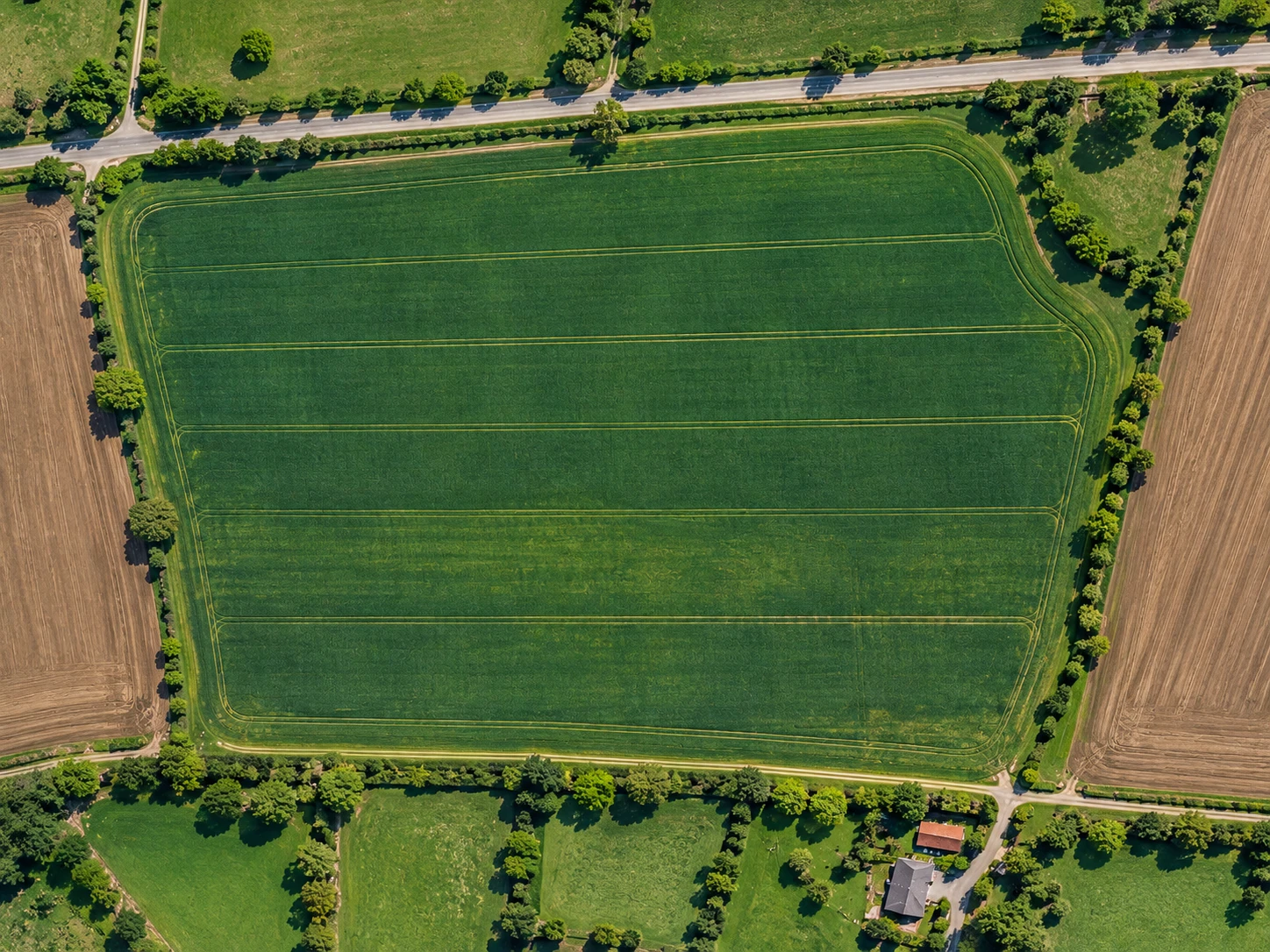
In maize or lettuce fields, orchards and meadows, we mark sparse growth and bare patches. You can then focus field checks on the areas where the cause needs investigating.
Soil-fertility assessment also requires soil-sample analyses. We combine these results with growth maps to support fertilisation planning.
If multispectral imagery is available, we can add vegetation maps, such as NDVI, as another way to compare plant growth.
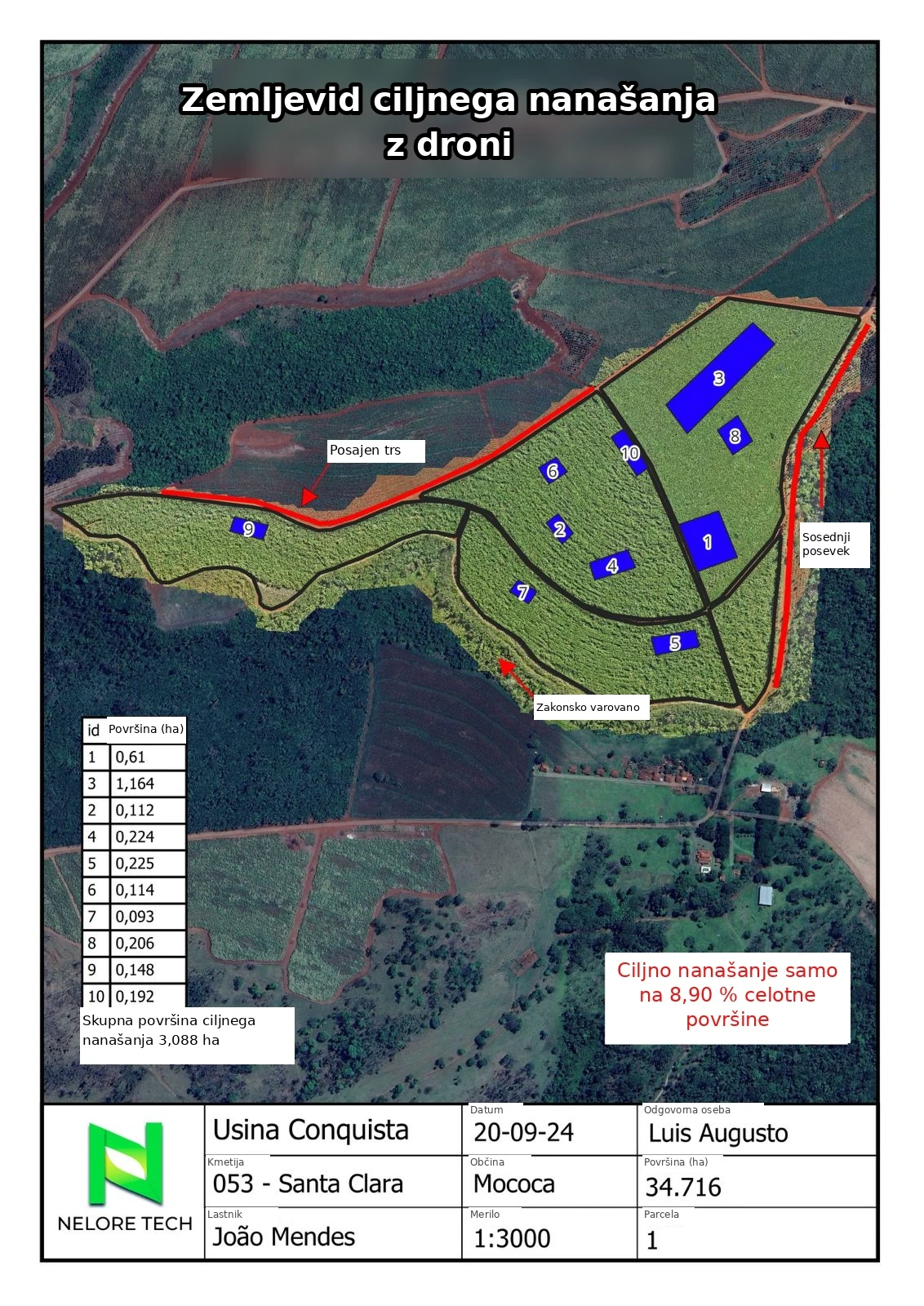
Quantities are calculated from the area and the application rate set by you or your adviser. Where needs vary across a field, we prepare a separate calculation for each zone.
The table lists areas, application rates and total quantities to prepare for the work.
In an apple orchard or a lettuce field, we identify empty positions and count plants that are clearly distinguishable in the image. This shows where replanting may be useful.
Counts are checked against the images and grouped by row or plot.
Compare successive captures to see whether differences in growth are increasing or narrowing. Keep a record after field operations and identify where another visit is needed.
Dated maps and a short explanation of the visible changes.
We map visible weeds so you can check affected patches and plan spraying by zone.
The crop, weed type and growth stage determine what can be distinguished in the images.
We measure empty stretches along the rows and estimate the missing share of the crop. The result shows which parts of the field have the most gaps.
An estimate of yield loss in tonnes requires additional crop and expected-yield data.
We count visible animals on a pasture or in a pen and check for duplicate detections. Totals are prepared for each selected area.
Trees, buildings and overlapping animals can hide part of the herd, so the result covers only animals distinguishable in the image.
We review the result with you: what the colours and numbers mean, which locations need checking and how to use the information in your work.
If you need a file for a sprayer, spreader or other equipment, we agree and verify the supported format beforehand.
Before analysis, we check what the images can reveal for the crop and growth stage. Fertilisation planning also requires suitable soil data and agronomic interpretation.
Tell us what you need to check on your land.
Send an enquiry ↗